According to UN global projections, by 2050 approximately seven out of ten people will live
exclusively in cities. This makes the urban heat island (UHI) phenomenon a key issue for
public health, urban infrastructure development and access to selected ecosystem services
in terms of negative climate change. Recognising the importance of these problems, the
AETHER project selected UHI as one of three use cases for the xAI application.
In our previous post, we presented the first part of our Urban Heat Island (UHI) application
resources: an AI-ready dataset on Guatemala City. However, to create a robust and reliable
solution that provides insight into city hotspot maps, we need additional data. Today, we
would like to present another element of our database: a UHI modelling dataset for Krakow,
Poland, ready for use by AI.
The Krakow-UHI dataset consolidates remote sensing products, acquired at both satellite
and airborne sensors, as well as topographic and socio-economic geospatial data, accessed
from both global and national public repositories:
Satellite-based Earth Observation (EO) products:
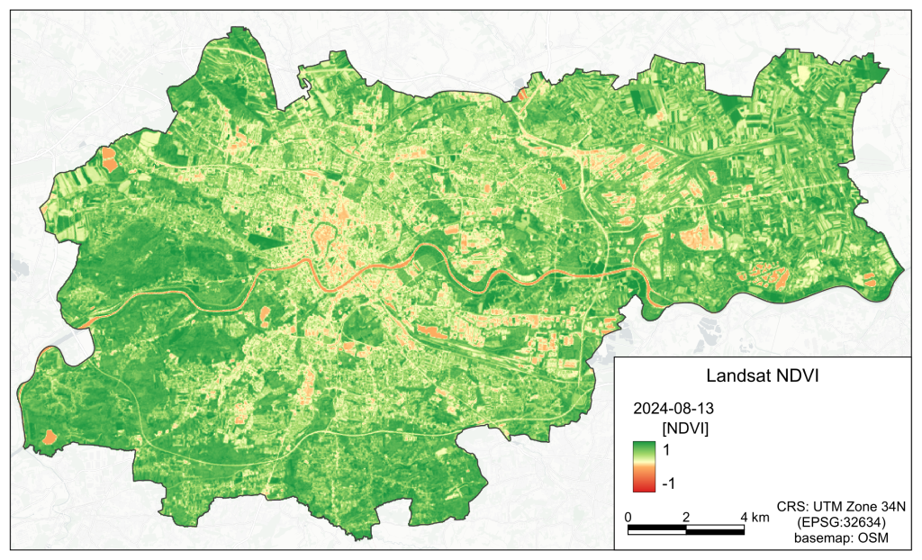
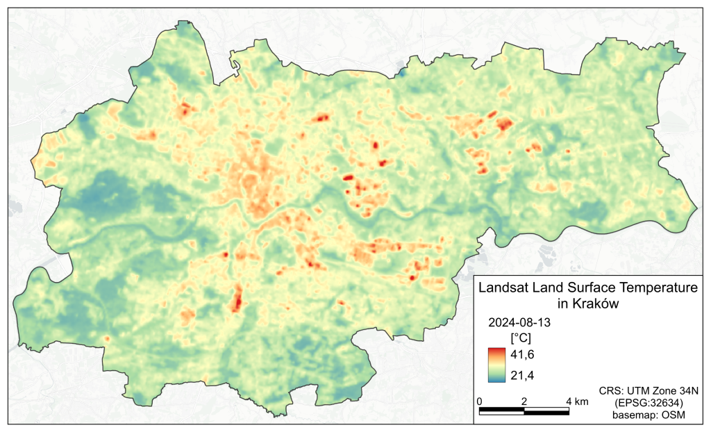
- Land Surface Temperature (LST; Landsat-8/-9, NASA) and vegetation
indexes time series, spanning across 2020-2025 period and capturing
seasonal temperature & vegetation development variability for the entire
Krakow city (temperate climate zone); - ESA Copernicus products: HRL - Tree Cover Density, Herbaceous
Vegetation and Imperviousness Density layers as well as CLC+ Backbone
Land Cover classification, based on Sentinel-2 (ESA) data.
Airborne remote sensing data:
- ALS LiDAR products: tree canopy height and forest cover, vegetation volume,
buildings height and volume, HVV2BV index - data that aims to explore the
impact of the urban green infrastructure and its 3-D structure on the
surrounding temperature. - ALS LiDAR Digital Elevation Model derivatives, such as slope, aspect, and
topographic indices (TPI and TRI), as well as annual potential solar radiation,
explaining how topographic conditions can influence local microclimate.
Socio-economic datasets:
- Population density
- Land use classification
The dataset is structured into a 30 m grid, where statistics of abovementioned
products describe the local conditions of the grid cell. Constructed according to the
Guatemala City dataset template, the Krakow dataset is an important addition that will
enable the detection of urban heat hot-spots and their main contributing factors. It will also
provide indications of practical strategies for adapting the city to the changing environment.
As with all data published as part of the AETHER project, the dataset is fully FAIR-compliant,
ensuring it meets industry standards. We are happy to share more detailed information with
you. To find out more, please contact the AETHER team.